GDACS Knowledge
The Global Disaster Alert and Coordination System (GDACS) was created in 2004 as a cooperation framework between the United Nations and the European Commission, in order to address significant gaps in information collection and analysis in the early phase of major sudden-onset disasters.
For the past decade, GDACS has drawn on the collective capacity of disaster managers and information systems worldwide to facilitate international information exchange and decision-making.
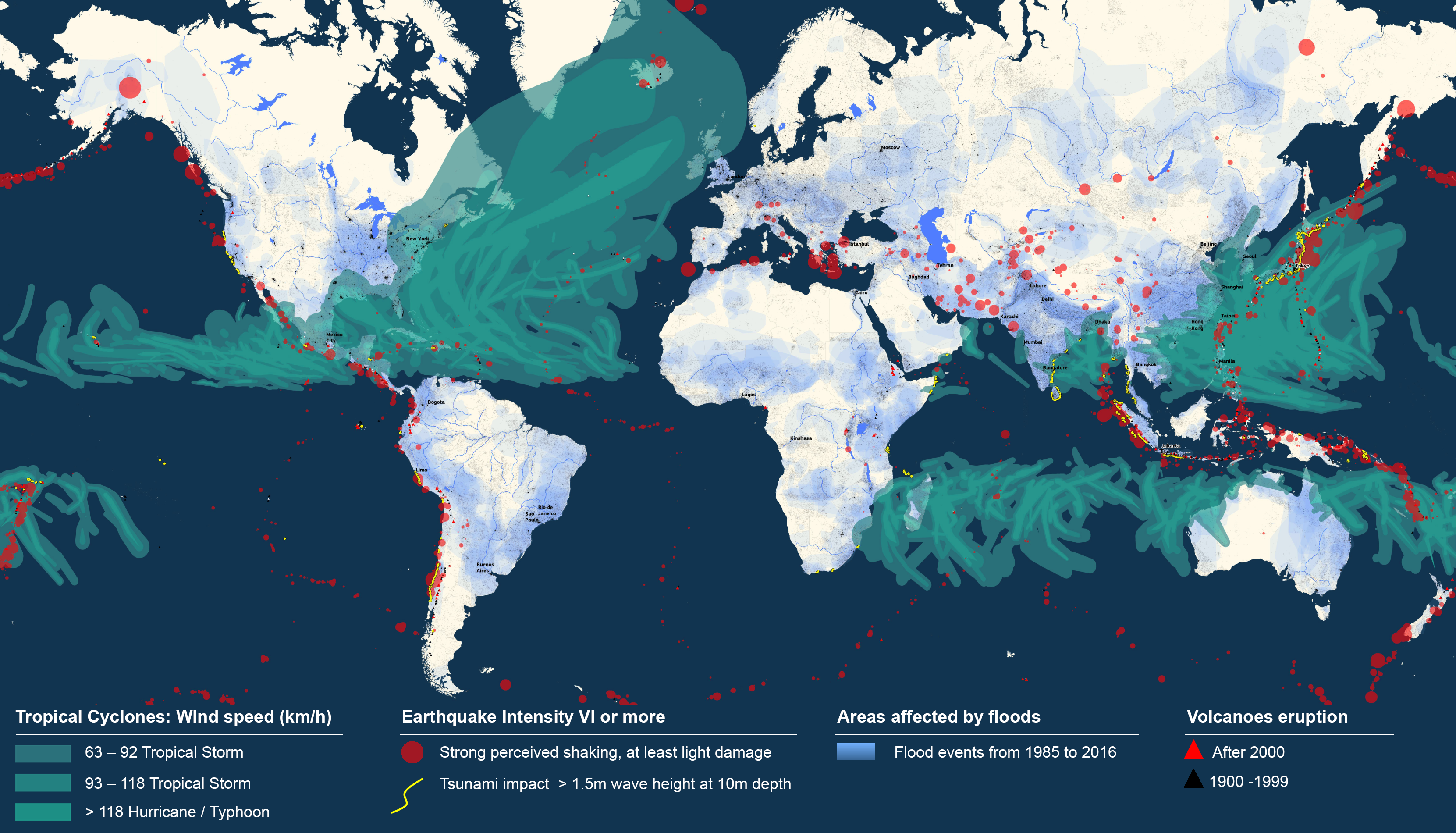
The selection and alert level of natural hazards in GDACS is based on automatic impact assessment models. GDACS software continuously monitors or receives scientific data on natural hazards in order to run analytical models. Information about the location, strength and other characteristics is then used to calculate the affected area and the expected impact. Different models are used for different disaster types. Subsequently, the potential consequences of the event are assessed by calculating the population within the affected area and their vulnerability.
Currently GDACS alerts are issued for earthquakes and possible subsequent tsunamis, tropical cyclones, floods and volcanoes. Regarding earthquake, tsunami and tropical cyclones, all calculations and assessments are done automatically, without human intervention. Studies are under way to include floods and volcanic eruptions in this list, which are currently manually introduced. Research and development is continuous to improve the global monitoring.